
The supplementary information provided in this QR-code accessed section takes the form of a series of questions that you may have about the ‘Where?’ section of the exhibition.
- What historic counties does Offa’s Dyke traverse?
From south to north: Gloucestershire, Herefordshire, Radnorshire, Shropshire (south), Montgomeryshire, Shropshire (north), Denbighshire, Flintshire.
(NB Offa’s Dyke never did exist in the former counties of Monmouthshire and Brecknockshire; the Offa’s Dyke Path, however, nowadays traverses parts of both counties).
- Which Early Medieval kingdoms and districts did it once cross, or face?
This is an extremely complex and difficult question, mostly because there is so little information about the boundaries of early political entities in the Welsh borderland, and what labels were applied to them in those distant times. The Kingdom of Powys was, for instance, most likely an overlordship composed of a loose confederation of princedoms or minor kingdoms based upon topographically definable sub-regions.
Mercia, meanwhile, was far from homogenous. It was only during Offa’s reign, for example, that the hitherto independent kingdom of the Hwicce occupying the area of south Worcestershire and Gloucestershire was ‘demoted’ to the status of a province of the Kingdom of the Mercians.
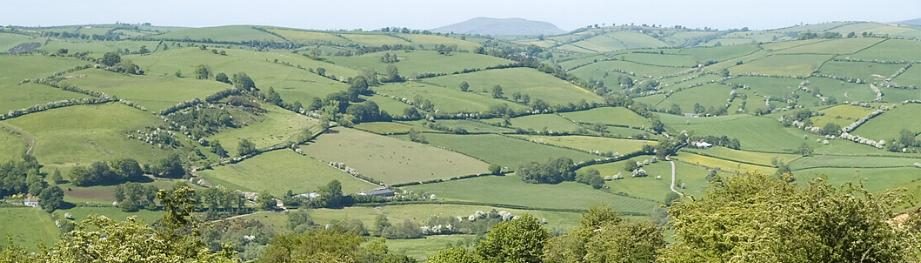
We know that the district of Rhos, south of modern-day Abergele, was a semi-independent entity that was fought over variously by Powys, Gwynedd and Mercia across at least 100 years.
We suspect that the Kingdom of Brycheiniog based upon Brecon was at least embryonic by around AD750. It is likely that the course of Offa’s Dyke in north Herefordshire was substantially determined by the influence of Brycheiniog in that part of the Wye valley to the east and north-east of present-day Hay-on-Wye.
The Kingdom of Ergyng occupying today’s south-central Herefordshire was known to have been one of the earliest coherent districts of south-eastern Wales with its own diocese at least as far back as AD600 and perhaps earlier (with its ‘founding’ bishop, Dubricius, known later also as St Dyfrig, recorded as early as the late 6th century). By AD780 it was struggling to maintain its independence from Mercia and may have entered into treaty relations by this time. This would potentially explain why the Dyke appears to have respected its territory south-west of Ross-on-Wye and is absent between there and Hereford.
The Kingdom of Gwent was a powerful polity in south-east Wales as the direct successor to the sub-Roman territorial lordship based upon the Roman town of Caerwent whose walls remain so prominent today just to the west of Chepstow. One reason why the Dyke was so prominently sited well above the east bank of the River Wye in Gloucestershire was to serve as a warning and reminder to the people of Gwent that the area now known as the Forest of Dean had been permanently annexed by the Anglo-Saxons. The aim of the English in so doing was probably to secure the important iron industry of the Forest of Dean.
- What is its relationship to historic towns?
There are sixteen or so historic towns situated close to Offa’s Dyke along its course. From south to north these include Chepstow, Monmouth, Ross-on-Wye, Hereford, Kington, Presteigne, Knighton, Clun, Bishop’s Castle, Montgomery, Welshpool, Oswestry, Chirk, Llangollen, Mold, and Prestatyn. Each has its own character and time of foundation, and of these towns only Hereford was in existence when the Dyke was built (though Chepstow may have been created soon afterwards).
- Was there a particular importance of Knighton in this landscape?
Knighton (Tref-y-clawdd) is special for many reasons both historic and geographical. However, in the context of Offa’s Dyke its importance lies in the fact that it is unique as the only settlement anywhere that is sited actually upon the line of the Dyke (as its Welsh name makes clear). Two successive castles were built by the Anglo-Normans here, and the current national boundary is at the River Teme. The town therefore sits at the intersection of major boundaries.