
The supplementary information provided in these two QR-code accessed sections takes the form of a series of questions that you may have about the ‘How?’ dimensions of the creation of the Dyke described in this part of the exhibition.
Panel 7: How was the Dyke operated?
- Was Offa’s Dyke a defensible barrier?
The answer to this is closer to the identical one posed many times for Hadrian’s Wall in northern England than might be supposed, given that it is certain that there were military garrisons of the Roman army occupying forts along that frontier and there is no indication of the existence of the same in the Wales/Mercia borderland. This is because the gates in the Roman Wall were used chiefly as sally-ports through which a Roman force could move rapidly to counter any attack. Hadrian’s Wall itself for most of its history acted as a reconnaissance platform from which to summon forces in forts on or behind the Wall to intercept any hostile force approaching from the north.
Offa’s Dyke would not have functioned in exactly same way, although the principles were likely to have been similar. Occasional patrols may have enabled signal beacons to send word eastwards of approaching forces, that could have been intercepted by modest forces assembled from districts in or close to the military zone to venture out of the gateways to intercept hostile forces.
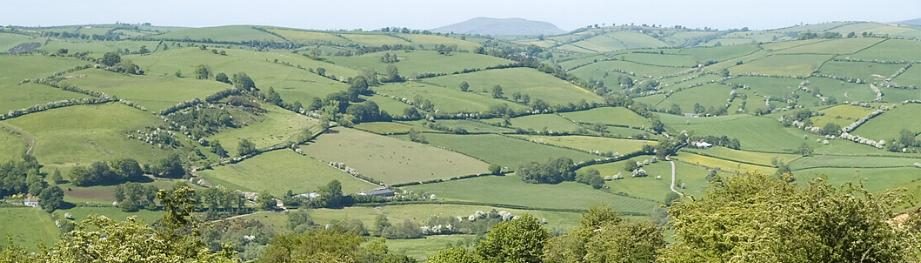
- Were there features of the Dyke that we cannot see today?
The gateways through the Dyke are one obvious such feature. In which case, how do we know that there were, in fact, such gateways? The answer is, ‘through the configuration of the earthwork at various obviously likely crossing points.’ There may also have been watch-towers, timber walkways, palisades and bridges. However, so little archaeological excavation has so far been done on well-preserved parts of the Dyke and on a sufficient scale to have located any such traces.
The best circumstantial evidence that we so far have concerning the existence of gateways is the physical configuration of the linear earthwork as it approaches likely openings/gateways from north and south. One of the best locations to visit to see such a likely original gateway (as it survives in the form of low earth banks) is at Pen Offa on the boundary between Discoed and Evenjobb (Einsiob) parishes in Radnorshire (Powys).
There is also new circumstantial evidence for the existence of both a bank-top walkway and a (presumed timber) bridge along the line of the Dyke as it crosses the Camlad river, north of Montgomery. The location of the bridge, if such it was, is indicated by a very short pronounced ‘kink’ in the line of the bank of the Dyke as it crosses the floodplain and intercepts a former stream channel.
- If there were gateways, how did they work?
There is no reason to believe that all gateways through the Dyke would have taken the same form; or that each would have performed the same function. To begin with, it is likely that there were both valley-floor and ridge-top (or hillside) passage-points, potentially serving different kinds of traffic. At two locations there are what look like large artificial level earthwork platforms adjacent to and overlooking routeways and possible valley-floor gateways: interestingly, both are sited close to the foot of north-facing slopes.
It is possible that some gateways were specially designated as locations where animals could be corralled and import tolls paid. These would have had ‘pounds’ for this purpose located on the western side of the gateway, in which stock could be penned prior to their admission into Mercia where they were destined for sale.
- Were there any work-camps or defensive works additional to the Dyke itself?
Although there have been ‘candidate’ sites suggested as possible locations for contemporary and associated defensive works, none have yet been proven. One question that has arisen is whether pre-existing (Iron Age or Romano-British) fortified enclosures could have been re-used for this purpose. One candidate such site, located immediately to the east of the line of the Dyke, is Burfa Camp which overlooks the Radnor Basin between Kington (Herefordshire) and Presteigne (Radnorshire/Powys). Another is Beacon Ring, a fort site (owned by the Clwyd-Powys Archaeological Trust) at 408 metres above sea-level on one of the crests of Long Mountain opposite Welshpool. Offa’s Dyke itself passes this site less than 500 metres downslope (and 100 metres lower in elevation) just to the west of this site, while the Offa’s Dyke Path crosses the western ramparts. Muster locations for Mercian armies on campaign have been tentatively identified at Sutton north of Hereford and at Rhuddlan on the River Clwyd.